

Overview
c:geo is a geocaching app for discovering, navigating to, and organizing caches from an Android device. Its live map helps you see nearby geocaches, while search tools let you narrow results by difficulty, terrain, size, and other criteria. You can choose Google Maps or OpenStreetMap for navigation, use a compass or an external app to reach a cache, and save cache information directly on your device. Offline functions and map files are useful when you are exploring beyond a reliable internet connection. The app also includes tools for organizing stored caches and managing trackables during a geocaching trip.
What You Can Do
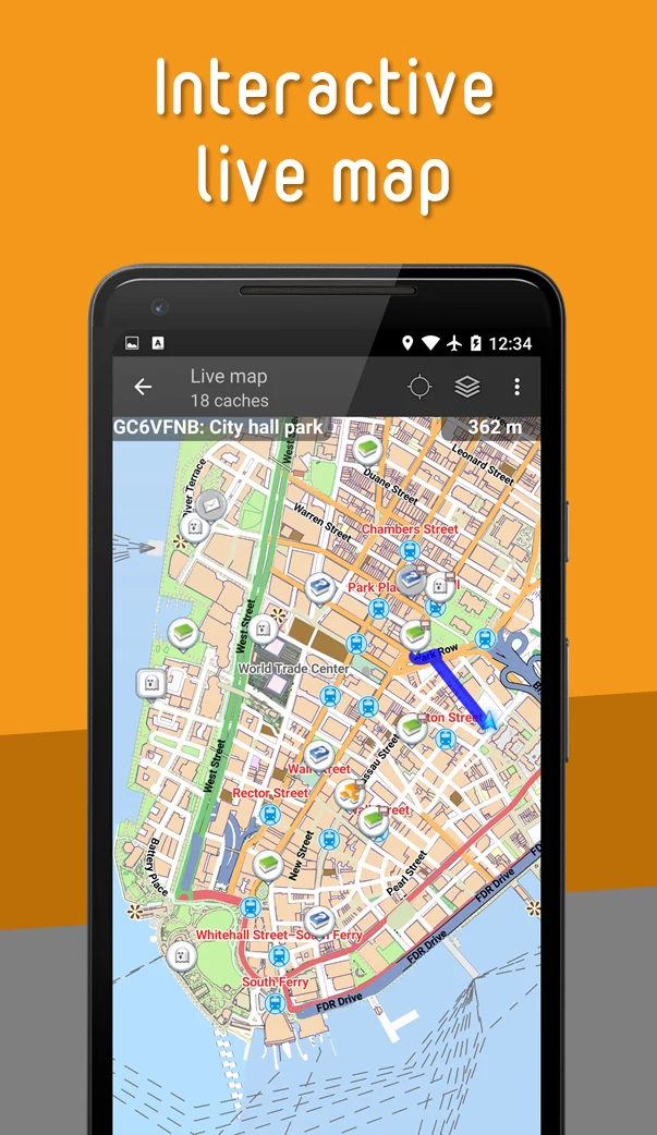
⭐ View nearby caches on a live map and use the map as a starting point for deciding which locations to explore.
⭐ Search with detailed criteria, including cache difficulty, terrain, size, and other available attributes, to find locations that match your plans.
⭐ Navigate toward a selected cache with the built-in compass, Google Maps, OpenStreetMap, or another external navigation app.
⭐ Store cache information on the device so that relevant details remain available for offline caching activities.
⭐ Organize saved caches into different lists, making it easier to separate locations by trip, area, or another personal system.
⭐ Discover and manage trackables while geocaching, including keeping track of items in your trackable inventory.
Using the App
A typical trip can begin with the live map or an advanced search. After selecting a cache, you can choose a navigation method that suits the situation, such as the compass for direct guidance or a map application for broader route planning. Before heading offline, save the cache information you need and use offline map files where available. Separating stored caches into lists can also make larger collections easier to review. During the outing, the trackable tools provide a dedicated way to discover and manage travel items alongside the cache-finding workflow.
Why It May Appeal
✅ It combines cache discovery, search, navigation, saved information, and trackable management in one geocaching-focused app.
✅ Multiple map options and navigation methods give users flexibility when planning routes or approaching a cache.
✅ Offline functions support geocaching in places where an internet connection may not be available, provided the relevant information and map files have been stored beforehand.
Developer
c:geo is developed by the c:geo team.