


Bonjour RATP helps people plan and monitor journeys on Paris public transport, combining information for the metro, RER, tram, and bus networks in one mobile app. Its main tools include live departure boards, route planning, interactive maps, station details, and alerts about disruptions or planned works.
Planning journeys across Paris
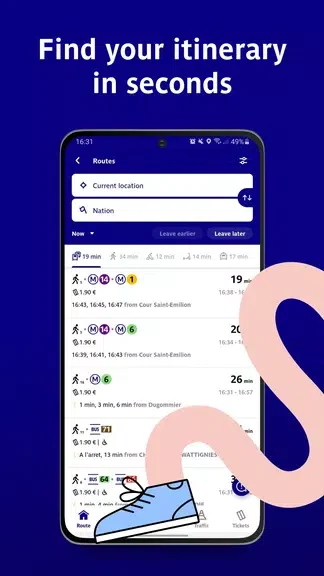
The journey planner accepts an origin and destination, including station names, addresses, and points of interest. It presents route options that can be compared by travel time, number of transfers, and walking distance. Suggested itineraries include estimated durations, transfer locations, and step-by-step directions. When a line is disrupted, the planner can show alternative routes so that users can weigh speed against the number of changes or the amount of walking involved.
Live departures and network information
Departure boards provide live timing information for platforms and stops, including reported delays or cancellations. Interactive network maps display line colors and interchange stations, while station pages bring together practical details such as nearby entrances, first and last train times, and connections with other transport modes. The app also includes information about bike-share and regional train connections where these are associated with a station.
Service alerts and routine travel
Bonjour RATP can notify users about service conditions affecting selected lines or stations. Notification preferences can be adjusted for regular commuting needs, and the app brings together information about delays, scheduled maintenance, works, and strikes. Favorites provide quick access to frequently used stations and routes, while home-screen widgets can be used as shortcuts to commonly checked information such as a nearby station's departures.
Accessibility details before departure
Station entries include accessibility information that can be reviewed before a journey is planned. Depending on the station, this may cover step-free access, elevator availability, and platform layouts. These details help users identify routes that better match their access requirements rather than discovering station conditions only after arriving.
Maps and selected offline information
Saved routes and downloaded network maps remain accessible when the device is offline. This can be useful in underground sections or other places with limited connectivity. The app's description also states that background updates refresh information while limiting interruptions, although live departure and alert data depends on current network information.
Personal settings and privacy controls
Users can save favorite stations and routes, adjust notification preferences, and create separate user profiles for different sets of trips and alerts. Location services can be enabled to support route suggestions, while privacy controls allow users to limit location sharing and push notifications. The app may collect usage data to improve services and provides options to opt out of analytics and targeted features.